Cancún

We were going to do this trip with 2 other couples, for my friend’s B-day, but Juli one of our friends got pregnant and they did not wanted to risk it, so they canceled the trip with us. Since Juli made all the reservations she canceled her hotel. The rest of us hoped to the plane and we got to Cancún.

When we got to the hotel unfortunately the hotel was in a bad stage and the manager was rude to us. I guess the pictures on the website were not as what they seemed to be, and we made a reservation for an all inclusive and it was not what they had promised us. The four of us were disappointed, and we did not knew what to do, since we weren’t the ones that made the reservation. We began calling our friend (the one made all the trip arrangements) and then out after spending half of the day trying to arrange our sleeping situation, we left the hotel and began to look for something else. We heard that the Hotel Barcelo was a good hotel, so we went to the hotel and asked for a room for the four of us. Since it was 4th of July, the prices were very high! Fortunately we found a deal on-line, and we were able to book a hotel with a very good deal.

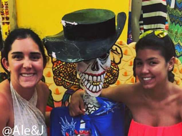
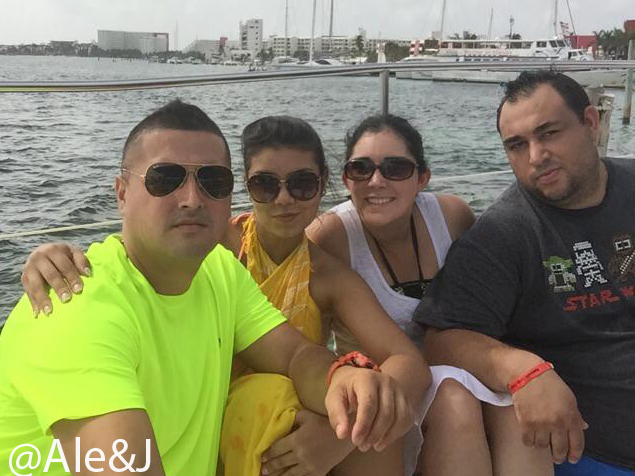
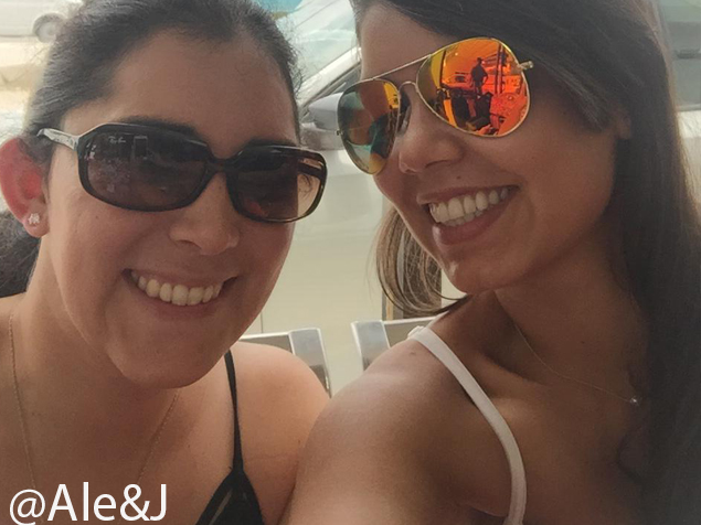
After we settle at the hotel, we decided to have a few drinks at the beach and then we went to bed. The next day, we went to Isla Mujeres in a boat ride. It was a great experience. On the boat we snorkeled, had some food and had an amazing time with the crew. Once we got to Isla Mujeres, we entered the little shops and simply immersed with the food and culture. Once the boat ride was over, we went back to the hotel and my friends and I went straight to bed. My husband J, made a reservation at the hotel restaurant the night before, so he just went down and ate some dinner.

The next morning J woke us up really early, and we began our journey to the magical city of Chichenitza, a large pre-Columbian city built by the Mayas during the Terminal Classic period where we spent the whole day and had a great time. Then, we went to a natural well called Cenote. Cenotes form under water and they are associated with the Yucatan Peninsula of Mexico. Sometimes the cenotes were used by the ancient Maya for sacrificial offerings.  These wells are common geological forms in low latitude regions such as islands, coastlines and platforms with little soil development. The water of the Cenote was so cold it refreshed us the whole rest of the afternoon. On our way back to Playa del Carmen he had to stop on a toll, but we did not had any cash on us. Fortunately we were able to borrow some money from the car behind us who was nice enough to follow us to the next ATM machine, so we could pay him back.

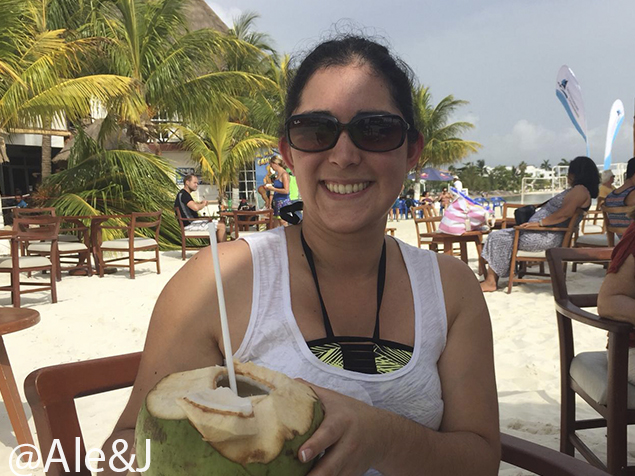
We had so much fun at Cancun, we ate amazing food, the people were super kind and made us feel welcomed. I would definitely go back and have another adventure in that magical place.

I hope you liked this post. Add me on Instagram @alexnavas2000

How do we plan a trip?

My husband J is usually the one that get’s the idea of traveling and then after a hours and hours of reasearch we begin the planning of the trip.

He usually begins with Google, just looking at what to do and where to do it kind of thing. But he has an amazing sense of organization that he begins to plan everything in a Excel Spreadsheet. I know that there are so many apps or other programs that helps to plan a trip, but he just do it the old fashion way.

He begins planning the days that we are going to be there, and what are the best trails and how they are divided in hard, moderate or easy category.

J’s calendar

He does a lot of reaserch! when I look at his computer he has like 50 windows open with all the things that have to be done in a specific location. The first thing that he does is to find a specific campground.

He goes to recreation.gov and plans the specific campsites. When you are planning to camp remember that there are national parks that you have to reserve your camping spot 6 months in advance! Once he finds a campsite and reserve it he begins to plan what to do depending on the location of the campsite. From there once he has the camping amenities he begins to plan what to do around it.

Usually I am a big Pintrest fan, and I begin telling him what are the places that are very scenic. There are many places that people recommend us to go, but it all depends on how far are those places and the miles between them. After we find the options that we want to see and explore, we began looking at revews at Trip Advisor and what people say about those places. When we travel, we have to take in consideration that there are many opinions on what people like and do not like, we all observe the world diferently and if you believe an option is not very worthty to visit take in consideration that I might think is an amazing place to visit.

Another main factor that we take in consideration is food! We just love the reviews from Guy’s Fieri This trail is terrifying, but don’t worry they have chains to help you on your trail. Dine’s Drivers and Dives. He finds all this local places that are very interesting and if we liked some of the restaurants that he talks about it on the show we usually drive to that location! Once I finds a camp site that he likes and works for both of us . If there is no campsite in the park that work for us he looks for local campsites and books it until he finds it. After that first campsite is booked the rest of the trip is set! (hehe not really), but it help us and guide us were do we want to go, and what are the locations that we liked.

Here is a picture of a map that tell us all the rest areas. The information can be found at http://restareas.appspot.com/

Depending on the rest areas and we plan our amount of driving that we do. We usually drive 3 hours maximum and we stop for stretching, coffee and snacks. Once he set’s up that rest area he finds the closest city near the first national park or destination that we want to go.

In the long run the key of any trip is to have fun, enjoy your time and discover what the world and nature have to offer you. We live in a time that we have to produce and have money to be happy, but for us money is not the most important thing. Our life philosophy is to enjoy life, respect each other and work together towards a same goal, the goal of being happy and to enjoying every second that we can.

I hope you liked this post. Add me on Instagram @alexnavas200

Zion

How does our adventures begin? Well, we have a destination in place and then we begin with the research that eventually leads us to the plan. This trip was our first that we needed to fly into a destination, so we packed our Coleman tent and the rest of our clothes into the carry on bags and began our journey.

Zion National Park location is Southern Utah. Since we were flying we came in to McCarran International Airport in Las Vegas were usually could find pretty good they have good renting car rates.

After we rented our car the adventure began. J began driving from Las Vegas at 11:00 PM and 4 hours latter we arrived to the lower Antelope Canyon tour. We made the reservation of the tour online, so we just parked on their parking lot and waited until the tour opened. The Navajo name for “Hasdeztwazi” (meaning “spiral rock” arch shaped), and years ago, the formation of the pronghorn antelope freely wandering in and out of the canyon has created its English name. This incredible gorge is eroded by nature’s ten thousand years, sanding the local sandstone into different shapes, textures, and structures, become what we see today.

Solar clouds continue to change, scatter light from different angles and colors into the stone walls of antelope canyon, through the reflection of a canyon rock, formed a dazzling color, light and shade. We began our tour going down a little stairs and then the tour guide began to explain about the formation of the rocks and how important that is not to touch the rocks due to their smoothies and erosion of the rocks. The formation of this canyon was due the Navajo Sandstone, primarily due flash flooding.

After the tour we began our jorney to Zion National park. The first trail we made was The Narrows. Everithing in the park takes life from the Virgin River’s scarce desert waters. The landscape changes constantly and the canyons deepen to create forested highlands and towland deserts. The animals take shelter inside the canyon and it becomes their sanctuary.

The first hiked that we did was The Narrows. Hiking in The Narrows upstream as far as Big Spring does not require a permit. Doing the hike this way allows you to see some of the most spectacular and narrowest parts of the canyon. You can hike in the river for an hour and have a great experience.

The second day we woke up and began the journey for Angel’s Landing west rim trail. For this trail we had to take the bus that took us at the beginning of the trail. For this trail is necessary to take the Zion Canyon shuttle route and shuttle stop. During spring though fall, Zion Canyon Scenic Drive is open to shuttle buses only, so is necessary to park your car and ride the shuttle.

This trail is terrifying, but don’t worry they have chains to help you on your trail. This trail is 2.5 miles long with an approximate 1,500 feet elevation gain. The hike is rated as a class 3 difficulty based on the Yosemitie Decimal System. It begins at the Grotto drop off point on the park’s shuttle system, it roughly follows the path of the  Virgin River for some time along the West Rim Trail, slowly gaining elevation in sandy terrain.

Most of the trail is uphill on the way up to Angels Landing. As the trail gets steeper and leaves behind the river, it becomes paved. After a series of steeps or wooden logs, the trail goes through the area between Angels Landing and the Zion Canyon that is a gradual ascent.

This trail is definitely not for everyone, and trust me I was terrified when I began the hike, but at the end it was so rewarding and I had so much fun on the trail that the views and the reward of having done this trail was everything. That day it rained, so remember to pack ponchos and good hiking shoes and socks that would help you during your hike. Remember to always pack more water that what you would use too. It has happened to me that I get dehydrated during the hikes, so I have to make sure to drink plenty of water. Definitely is one of the hikes that I certainly would remember for ever!

I hope you liked this post. Add me on Instagram @alexnavas2000

Big Bend National Park

Big Bend is an amazing place to explore. It’s located in a remote part of southern Texas. The cell phone service is unreliable, and some of the park roads may require four-wheel drive. Our first stop began in a Hotel called La Loma del Chivo. We drove around 6 hours from our home in Austin Texas, to La Loma del Chivo in Marathon Texas. When we got to the hostel, it was very dark but we managed to enter and sleep. The room was filled with eclectic objects and it seemed a little bit scary.

The address for the hostel is 401 6th St, Marathon, TX 79842

La Loma del chivo

We got there at 10:30 PM. Once we arrived we needed to call a person that let us inside the room. She was very kind, and just asked us for the confirmation number and then let us in the room. The bathrooms were located outside the buildings but everything was clean. Once we got inside there were lots of artifacts and objects. There was also a big red curtain that divided the room, and you can observe that on the other side it was a storage room. After driving the whole day, we just took a hot shower and went straight to bed.

Next morning we woke up really early and began driving towards Big Bend National Park. This park is the boundary between United States and Mexico. One of the park’s best-known features is the Santa Elena Canyon, half of the canyon is on the United States side, and the rest of the wall covers above Mexico. The park marks the northernmost range of many plants and animals and many western species. The elevation contrast create different climates that makes possible the diversity of plant and animal life inside the park.

Once we arrived to the park we began the Boquillas Canyon Trail. This trail crosses the Terlingua Creek and ascend paved steps to a beautiful vista before dipping back down toward the water and into Boquillas del Carmen. This trail is a moderate 1.7-mile hike, it’s great for beginners who want to stretch themselves just a little, with magnificent views providing a well-earned payoff. It took us almost an hour to complete the trail and it was 1.48 miles approx. The most wonderful thing about this trial was that at the end we were able to observe the Santa Elena Canyon. At the other side of the Canyon you observe the Santa Elena Canyon Protected Area, and you can observe the amazing walls that surround you. You have to keep in mind that you need to bring lot’s of water to keep you hydrated, and a very good hat and sunglasses to protect yourself from the sun. After we drove to this amazing park we stopped on the wonderful teepee in Texas Located at Basecamp in the ghost town of Terlingua. This place is the perfect example to “Glamping” We stayed in the Yucca Teepee and the experience was amazing.

You have to reserve online, and once you get to the location, you need to call a phone number to let them know you arrived. The lady that gave us access to the Teepee was very nice. After settle in our teepee, we went outside and observe the amazing sunset and waited until the grand show or dark sky. Big Bend is designated as an International Dark Sky Park, so if you are a big fan of unplugging yourself and just watching the stars (like us) Big Bend National Park is the right place for you.

I hope you liked this post. Add me on Instagram @alexnavas200


Mount Ranier

Thanks for joining me!

Good company in a journey makes the way seem shorter. — Izaak Walton

It all began on May 14, 2018.

When my husband J told me about Mount Rainier National Park back in 2018, I had no idea that I eventually will fall in love with Nature and the rush for travel began.

This is our story, our trips and all the crazy adventures that we began doing when we set foot at the mountain.

We landed at Seattle at 1:35 am. After traveling from our home back in Austin Texas, we were tired and exhausted. We had a few hours until our first stop, then we began our hike on at 2:27 PM and ended back to the end of the trip at 5:19 PM.

The park was amazing! being able to see the Peak and being able to immerse yourself in Nature is the best feeling in the world.

Did you know that Mt. Rainier is still an active volcano? It’s currently dormant and last erupted in 1984, but it still technically active.

Our first stop was on The Butchart Gardens in Vancouver British Columbia.We arrived at 7 am, and began to explore the amazing garden.

The daily admission ticket for adults is $31 dollars. This garden began from a vision Jennie Butchart. She wanted a landscaping a sunken garden in its place, transforming the property for her family—and visitors—for generations to come.

Between 1906 and 1929, the Butcharts expanded The Gardens, designing the Japanese Garden on the seaside, the Italian Garden on their former tennis court and the fragrant, overflowing Rose Garden.

It is an amazing place to visit, the flowers are beautiful and you won’t regret coming here.

Our second stop was to ride around the city. We rented a bike by 9:00 am and began to explore the amazing city of Vancouver British Columbia.

After our Ride around the city we began our trip to The Capilano Suspension Bridge. This bridge. This Bridge cross the Capilano River and the District of North Vancouver in British Columbia, Canada. The bridge is 460 ft long and 230 ft above the river.

The entrance fee is 53,00 Canadian Dollars for adults. The current bridge is 140 metres (460 ft) long and 70 metres (230 ft) above the river.

It is part of a private facility with an admission fee, and draws over 1.2 million visitors per year.

By 1:00 pm we finally made it to Mount Rainier!

We got to the Paradise parking lots around 1:00 PM and the place was full with activity. We entered visitor center where we geared up for the 5+ miles on the Skyline Loop Trail, a popular trail leading to some breathtaking views of the mountain and surrounding area.

We began our trail around 2:27 and manage to come back by 5:19.

It was our first trail with snow, so it was very challenging and at the same time fun hike.

J and I began to walk at the Henry M. Jackson Memorial Visitor Center and just began to walk around it. We walked the look clockwise and we think it was the right choice.

As we packed our gear into the rented car, we wondered why we didn’t plan for more days at Rainier as it was so vast and beautiful. The address of the visitor center is Paradise Rd E, Ashford, WA 98304.

At the center you can rent the appropriate ski shoes for your snow hike.                                It was a wonderful experience and I am sure I will come back to this magical place.

I hope you liked this post. Add me on Instagram @alexnavas200